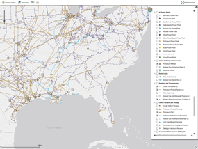
Just in case you don’t know yet, the United States Energy Information Administration announced in a press release dated June 10, 2014 on EIA’s official website that the U.S. Energy Mapping System is now accessible on all mobile devices.
There are two important EIA tools that users can now access anytime, anywhere with the latest information – the U.S. Energy Mapping System and the Energy Disruptions web page.
EIA’s U.S. Energy Mapping System not only informs the public about energy infrastructure, it’s also a useful tool for state and local officials who must deal with significant weather events,” said EIA Administrator Adam Sieminski. “Making these resources accessible on mobile devices is one way that EIA can help emergency response officials and the public readily assess the potential impacts of significant weather events on energy infrastructure in the United States.
EIA’s U.S. Energy Mapping Systems at http://www.eia.gov/state/maps.cfm and its Energy Disruptions web page at http://www.eia.gov/special/disruptions/

